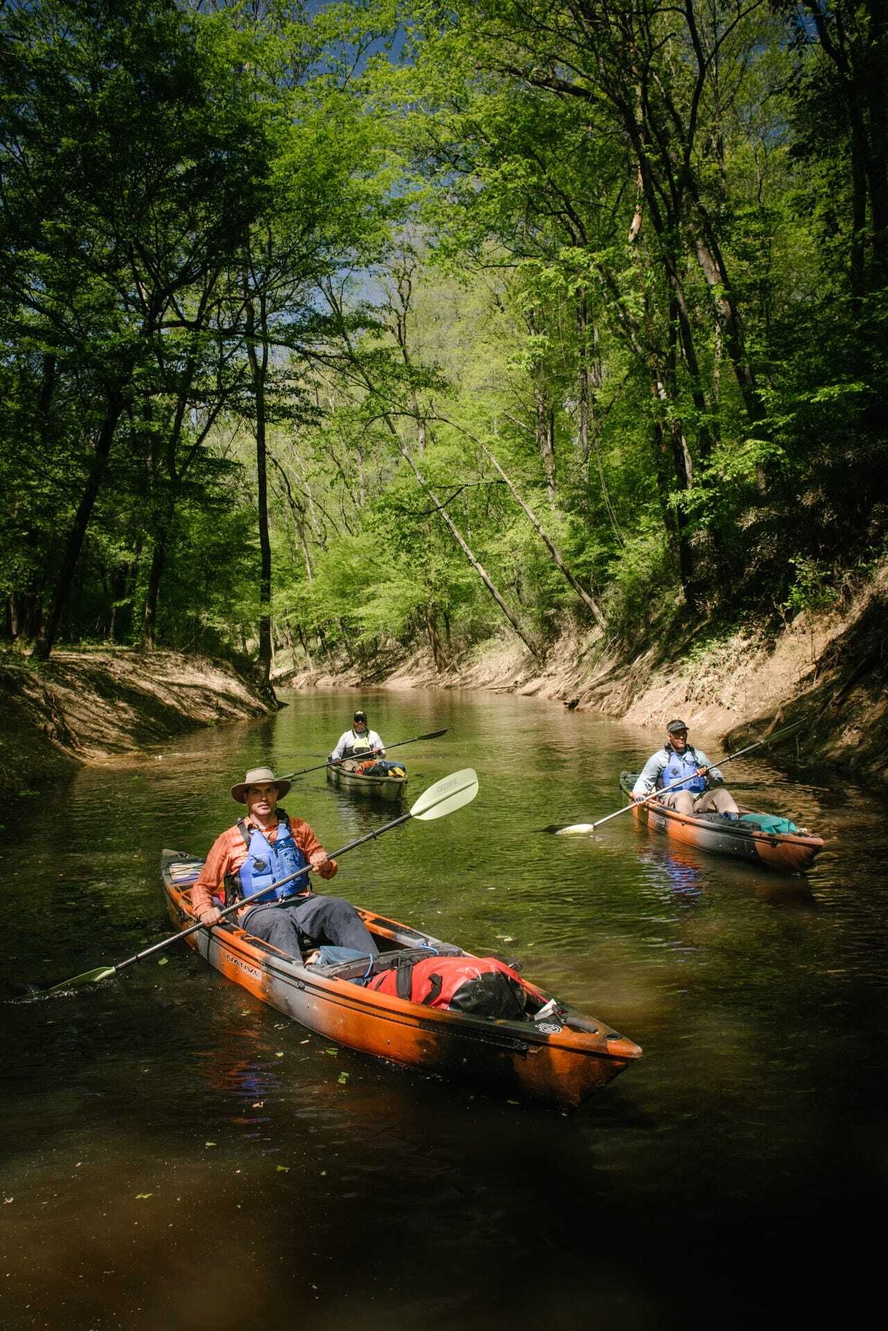
Nine years ago, when I was paddling down the Cape Fear River, our group stopped for lunch in Fayetteville. That’s a little bit misleading, actually, because if you’re on the water, there aren’t many restaurants that sit within easy view of1 the 146 miles of river between Lillington and Wilmington. What we actually did was pull up on a bit of sand that was sticking out from the mouth of Carver’s Creek, just south of the I-295 bridge. After we finished the sandwiches we’d packed, we paddled up that creek for just a little bit just to see what was back there. We didn’t go too far. After all, we had a lot of miles to put in before sundown.

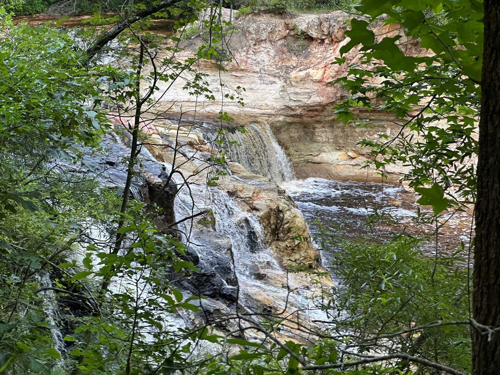
Turns out, we missed quite a bit! There’s a whole waterfall up that creek!
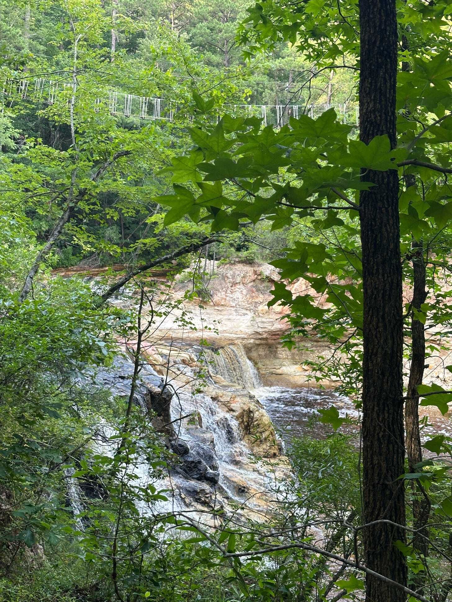
I finally got to see it last weekend, thanks to my son’s Boy Scout camping trip to ZipQuest. It’s an adventure park with eight zip lines with a bunch of staircases and Temple Of Doom-style bridges. What’s it like to be along on a camp out when the daily temperatures are above 90? Not comfortable!
That said, the whole thing is built to go over Carver’s Falls, a 150-foot-wide, two-story-tall waterfall that sits at the confluence of two creeks. It is, according to the ZipQuest folks, the largest waterfall between North Carolina’s foothills and the Atlantic Ocean. It’s one of the rare places where bald cypress grows next to mountain laurel. It’s a little bit shocking to see, honestly. When you drive around Fayetteville, things feel mostly flat, since most of the city lies just past the fall line that separates the Piedmont from the coastal plain. But there are some pretty big bluffs out there around the rivers and streams, and Carver’s Creek sits much lower than most of the surrounding area. Thanks to the zip line course, you can get a great bird’s eye view of it.
So, what’s it look like at ground level? Unclear. Because you really can’t get down there anymore.
There’s nothing nefarious afoot here. The waterfall and the 55 acres of property its sits on have been owned by the Bryan family since the 1963. They wanted to figure out how to keep it undeveloped and make a little money from it, so they got a contractor from Michigan to build a zip line course in 2009. “The beauty of it is we were able to preserve the land and share the land with the community at large,” owner Russ Bryan told the Fayetteville Observer in 2020. You can zip above the falls, but there’s not a public trail to the bottom.
There is, potentially, a way to get there, though. If we’d kept paddling up that creek back in 2016, we would eventually have reached the falls without trespassing. In North Carolina you’re allowed to travel on any navigable waterway, thanks to the old public trust doctrine (We’ll get into this a little more in an upcoming newsletter). What’s navigable? According to both law and court rulings, any waterway that you can canoe or kayak in is navigable, which makes streams, creeks, and rivers on private land into public highways. Can you get out on the shore? Nope! Can you stand up on the muddy bottom? Probably not!
Hence, as long as you’re floatin’, you ain’t trespassin’. But it’s also unclear whether we would have encountered thick brush, fallen trees, or extremely shallow water along the way. The waterfall is nearly a mile up Carver’s Creek from the Cape Fear River. There’s a great chance that we would have found something blocking our way.
You can’t just roll up to Carver’s Falls to have a casual look, but that wasn’t always the case. The falls were named for Samuel Carver, the dude who received the waterfall and the 640 acres around it from King George II in 1735. “There is little known about the use of Carver’s Falls,” states the ZipQuest website, which isn’t entirely true. It was once referred by local newspapers as “the mecca of Fayetteville picnickers.” One short story in the Fayetteville Weekly Observer in 1904 noted a moonlight picnic at the falls with a little bit of lament. “Carver’s Falls is a beautiful sylvan retreat, especially pleasing in the calm hours of the evening, under the light of the moon,” it states, “and yet there are hundreds of people in Fayetteville who have heard of, but have never seen, Carver’s Falls.” It was later owned by John Oates (not that John Oates), who would throw big parties at the falls. One, in 1921, attracted 500 people who consumed more than 1,000 ice cream cones (it was July). That same year, the local sheriff destroyed three moonshine stills nearby.
Still, the land was always private, but opened up occasionally with the benevolence of whoever owned it at the time. In 1930, Oates talked about donating the falls to the state to create a public park, but it apparently never came to be. Carvers Creek State Park, which sits to the northwest and doesn’t include the falls, wasn’t formally created until 2005.

In 1963, a state lawmaker and car dealer named Norwood Bryan bought the land in order to preserve it. He also continued to lease part of it out to the local Girl Scout organization, which used it as a camp for decades. In 1969, as the Kelly-Springfield Tire Company was getting ready to build a plant to the north, the scouts and others were able to get the stream reclassified so the tire factory couldn’t use the water. The plant had to discharge its waste into Fayetteville’s water treatment system instead. That kept a large amount of potential pollution out, and allowed the scouts to keep swimming at the bottom. (It’s not all that dirty even though the water, our zip line guides told us, always looks brown at the bottom and yellow as it goes over the falls.) In 1995 came another threat: The construction of I-295. Bryan pushed to move the highway further away from the falls as to not destroy the natural beauty of the place. Preservation didn’t mean opening the falls to everyone, though, and Bryan wasn’t exactly forthcoming about the exact location. In a 1995 article, the Charlotte Observer left them off of a map at Bryan’s request.
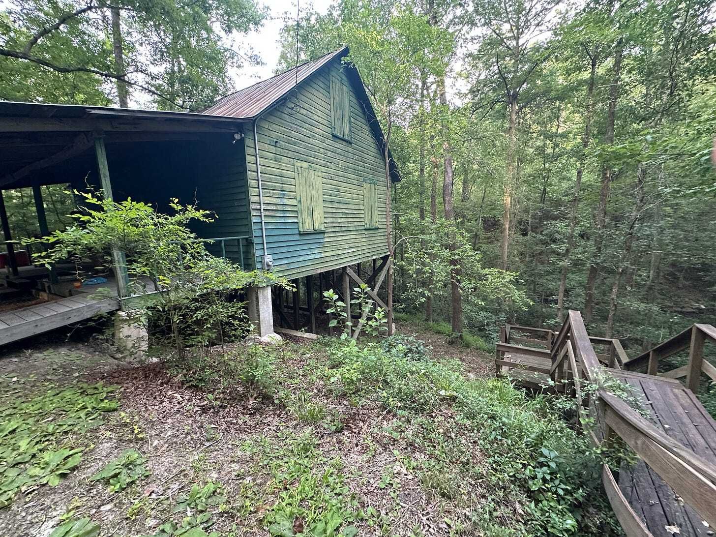
During his time as a state representative from 1966 until 1974, Bryan took up any number of environmental causes. He was also an Eagle Scout, and his sons and grandsons were also involved in scouting. Hence, our local Scout troop was able to camp next to an old mill, up above the creek. It was lovely, even though it was hot. But it’s still pretty private. You can’t just show up and go traipsing around for free.
Waterfalls feel a bit sacred. Humans have been drawn to them forever. Hence, they feel like they should be public things, preserved for the benefit of everyone. A bunch of waterfalls are in state and national parks. Soco Falls is just off of the roadside near Cherokee. You can walk behind Dry Falls in Jackson County. Over time, several of them, like Carter Falls near Elkin, have transferred into public hands and are accessible by trail. Others, like Cobweb Falls and Mitchell Falls (where Mt. Mitchell’s namesake fell to his death in 1857) are very private and not open to you and me. And this state has a long history of cool things—Grandfather Mountain and Chimney Rock—being privately owned but publicly accessible, provided you paid an admission fee (Those two were eventually turned into state parks).
That said, waterfalls are built different. Most are hidden back in the woods or behind mountains. Many take effort to reach. Photographers swoon over pictures of them. People love to swim at the bottom of them. The view, the sound, and the vibes make any hike to them, no matter how hard, worth it. But it’s understandable, especially in an era where natural places get loved to death, that not every amazing landmark should be open to anyone at any time. Part of the reason the Bryans created a zip line was to allow people to enjoy nature without trampling it. Hence, Carver’s Falls fall into an in-between area between public and private. You don’t get to visit on your own terms. But you can paddle in the water below if you put in the effort. You can pay to zip along above. And if you’re lucky, you can camp nearby and do the thing that people have been doing for generations: Sit down, have a picnic, and look at the view.

